Description
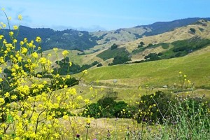 San Simeon – Santa Rosa Creek Watershed
Santa Rosa Creek Area Watershed lies within the southern portion of the California Coast Ranges. The watershed is bounded to the east by the Santa Lucia Mountain Range and to the west by the Pacific Ocean. The grouping of watersheds herein is consistent with the CalWater HUC 10 scale. The watershed contains 2 major sub-watersheds: Santa Rosa Creek, which contains Santa Rosa Creek and Green Valley (Perry Creek) and Villa Creek. Santa Rosa Creek and its tributaries flow mostly unobstructed down steep hill-slopes mantled with shallow soils and sparse shrub vegetation and through agricultural areas and the small town of Cambria before reaching the Pacific Ocean. Villa Creek begins in the Santa Lucia range flowing to the Pacific Ocean and encompassing a majority of the coastal area within the total watershed. The Town of Cambria is near the mouth of Santa Rosa Creek, downstream of the confluence with Perry Creek – the largest tributary in the Santa Rosa Creek sub-watershed. The urbanized area of Cambria is located within both the Santa Rosa Creek sub-watershed and the Villa Creek sub-watershed. Topography includes steep upland areas and low gradient valley bottoms bordering the reaches of Santa Rosa, Green Valley, Perry, and Villa Creeks. Cypress Mountain, the highest peak, lies in the Upper Santa Rosa creek watershed and reaches an elevation of approximately 3,411 ft. At its lowest elevation (sea level), Santa Rosa Creek flows through a lagoon contained by an annually formed sandbar at Moonstone Beach. The dominant land use is agriculture.
WATERSHED OVERVIEW
|
Hydrologic Unit Name:
|
Estero Bay 10
|
|
Water Planning Area:
|
Cambria WPA 2
|
|
Acreage:
|
46,997 acres
|
|
Flow to:
|
Pacific Ocean – (Monterey Bay National Marine Sanctuary)
|
|
Groundwater Basin(s):
|
Santa Rosa Valley, Villa Valley
|
|
Jurisdictions:
|
County of San Luis Obispo, Town of Cambria, Town of Harmony
|
|
Watershed Plans:
|
Santa Rosa Creek Watershed Management Plan (Greenspace Cambria, 2010), Cambria Forest Management Plan (Greenspace Cambria, 2002)
|
Full Data Snapshot
Download the Watershed Snapshot for more detailed information such as:
- Rainfall
- Geology
- Hydrology models
- Vegetation
- Special status wildlife and plants
- Land use
- Demographics
- Major changes in the watershed
- Watershed health
- Groundwater