Description
 San Luis Obispo Creek Watershed
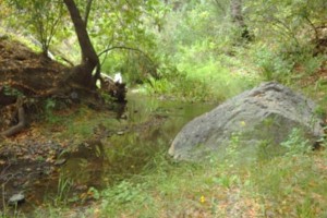
The San Luis Obispo Creek Watershed is a coastal basin located in southern San Luis Obispo County. The drainage rises to a maximum elevation of approximately 2,500 feet above sea level in the Santa Lucia Range. San Luis Obispo Creek flows to the Pacific Ocean and has six major tributary basins: Stenner Creek, Prefumo Creek, Laguna Lake, East Branch San Luis Obispo Creek, Davenport Creek, and See Canyon. The watershed is dominated by agricultural land uses including ranches and open space. The urban core of the City of San Luis Obispo is at the confluences of several tributaries with the mainstem starting in the upper watershed and bisecting the City. The unincorporated community of Avila Beach is adjacent to the mouth of San Luis Obispo Creek at the Pacific Ocean.
WATERSHED OVERVIEW
|
Hydrologic Unit Name:
|
Estero Bay HU 10
|
|
Water Planning Area:
|
San Luis Obispo/Avila WPA 6
|
|
Acreage:
|
53,271 acres
|
|
Flow to:
|
Pacific Ocean
|
|
Groundwater Basin(s):
|
San Luis Obispo Valley, Avila Valley subbasin
|
|
Jurisdictions:
|
County of San Luis Obispo, City of San Luis Obispo, Town of Avila Beach, Port San Luis Harbor District
|
|
Watershed Plans:
|
San Luis Obispo Creek Watershed Enhancement Plan (The Land Conservancy of San Luis Obispo County, 2002), Prefumo Creek Watershed Management Plan (City of San Luis Obispo, expected 2014)
|
Full Data Snapshot
Download the Watershed Snapshot for more detailed information such as:
- Rainfall
- Geology
- Hydrology models
- Vegetation
- Special status wildlife and plants
- Land use
- Demographics
- Major changes in the watershed
- Watershed health
- Groundwater