Paso Robles Groundwater Basin
The “Paso Robles Area Subbasin” of the Salinas Valley Groundwater Basin (locally referred to as the “Paso Robles Groundwater Basin” - see DWR Bulletin 118 Basin No. 3-004.06, lies in northern San Luis Obispo County following boundary modifications which removed the portion in Monterey County in early 2019. The subbasin is bounded by the Santa Lucia Range on the west, the La Panza Range on the South, and the Temblor and Diablo Ranges on the east. The basin overlies approximately 436,000 acres (681 square miles).
GSAs in the Paso Basin |
Groundwater Sustainability Plan & Annual Reporting |
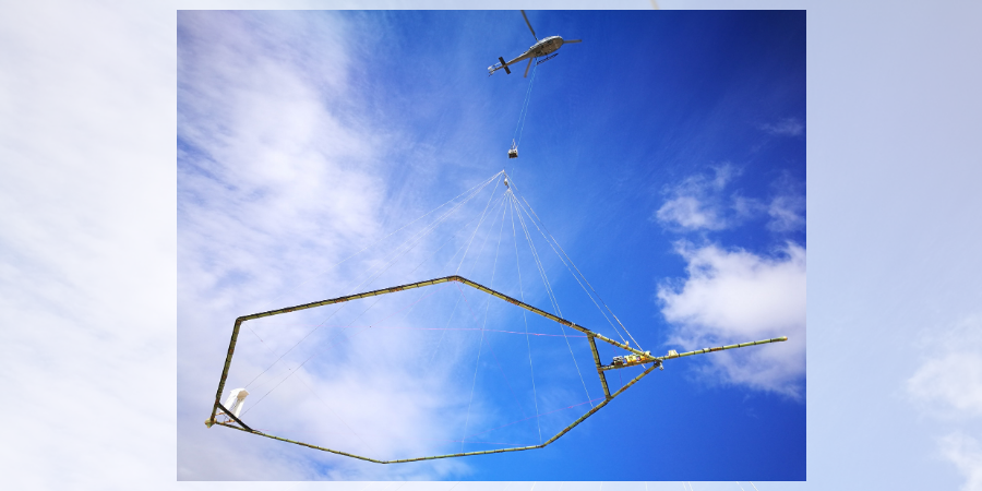
Paso Basin Aerial Groundwater Mapping Pilot StudyIn November 2019, the County of San Luis Obispo joined two other California counties in a pilot study through Stanford University using innovative technology that could change the way California collects information about groundwater basins. The data collected will also help the Paso Basin Groundwater Sustainability Agencies comply with California’s Sustainable Groundwater Management Act. See reports and other information on the Paso Basin Aerial Groundwater Mapping Pilot Study |
How do I get involved?
|
Mapping ResourcesClick the link above to access the SGMA Interactive Data Viewer for the Paso Robles Groundwater Basin! This is an interactive mapping system to help you to navigate around the Paso Robles Groundwater Basin by panning, zooming, or searching for a specific parcel or street address that you would like to locate. There are different map layers that can be shown and superimposed in this interactive mapping system such as boundaries of groundwater basins, cities, roads, SGMA eligible entities, and others by checking the layer names indicated on the left panel layer menu. To search and locate a specific APN or street address on the map:
|
Sign up for the SGMA Mailing ListClick here to subscribe to the SGMA email notification list! |