Los Osos Valley Groundwater Basin
The Los Osos Valley Groundwater Basin, DWR Bulletin 118 Basin No. 3-08, is bounded on the north by Park Ridge, on the south by Irish Hills, on the west by Morro Bay, and on the east by a drainage divide separating Los Osos Valley from San Luis Valley. The Los Osos Basin, as defined by DWR, is located in San Luis Obispo County and covers 6,990 acres (10.9 square miles).
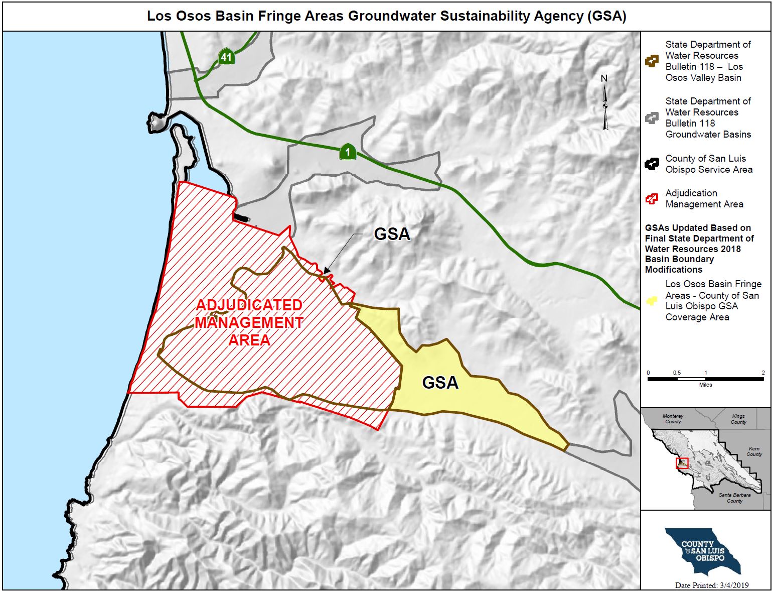
On February 11, 2019, DWR released the 2018 Final Basin Boundary Modifications for Los Osos Valley Groundwater Basin, including the following basin modifications:
- DWR approved the creation of two jurisdictional subbasins:
- Los Osos Area Subbasin (3-08.01)
- Warden Creek Subbasin (3-08.02)
- DWR approved the removal of the southern fringe area
- DWR denied the removal of the minor northern fringe area
Sustainable Groundwater Management ActIn 2015, the State legislature approved a groundwater management law known as the Sustainable Groundwater Management Act (SGMA). DWR categorized the Los Osos Valley Groundwater Basin as a high priority basin and designated the basin to be in a “condition of critical overdraft”. SGMA does not apply to the portion of the Los Osos Valley – Los Osos Area Subbasin at issue in the litigation (“adjudicated area”) provided that certain requirements are met by the Los Osos Basin Management Committee. The Warden Creek Subbasin and minor northern fringe area are located in the non-adjudicated areas of the basin, the County of San Luis Obispo formed a groundwater sustainability agency in to manage these basin areas within their respective jurisdictions (see “Final Basin Boundary Modifications Release” in Recent News Section below for more details). The map below displays both the adjudicated area exempt from SGMA, and the newly modified basin fringe areas that are subject to SGMA, pending the State’s prioritization basin results anticipated in Spring 2019. | ||
Recent News & Announcements
| ||
Meeting InformationThe County provides updates on SGMA at the Los Osos Groundwater Basin Management Committee (BMC) meetings regularly held on the 3rd Wednesday of every month starting at 1:30pm at the South Bay Community Center on 2180 Palisades Avenue in Los Osos, CA. Click here to view the Los Osos BMC Meeting Calendar. | ||
How do I get involved?
| ||
Interactive Map of the Los Osos Groundwater BasinClick the link above to access the SGMA Interactive Data Viewer for the Los Osos Valley Groundwater Basin! This is an interactive mapping system to help you to navigate around the Los Osos Valley Groundwater Basin by panning, zooming, or searching for a specific parcel or street address that you would like to locate. There are different map layers that can be shown and superimposed in this interactive mapping system such as boundaries of groundwater basins, cities, roads, SGMA eligible entities, and others by checking the layer names indicated on the left panel layer menu. To search and locate a specific APN or street address on the map:
| ||
Sign up for the SGMA Mailing ListClick here to subscribe to the SGMA email notification list! |