Adelaida Area Hydrogeologic Study
The San Luis Obispo County Flood Control and Water Conservation District is coordinating with the U.S. Geological Survey (USGS) and the Upper Salinas-Las Tablas Resource Conservation District (RCD) to conduct a groundwater study in the Adelaida area west of the City of Paso Robles (click here to view an interactive map of the preliminary study area). The goal of this study is to provide a better understanding of the groundwater conditions in the Adelaida area so that informed decisions can be made about managing local water resources.
Please visit the links below for additional information.
USGS Adelaida Study Website
Evaluation of Groundwater Resources in the Adelaida Area of San Luis Obispo County, California
Background Information
County Board items related to the Adelaida area groundwater study can be viewed at the link above.
Community Meetings
On Tuesday, February 27, 2024 at 3:00 p.m., a community meeting was held at the Polin Community Room at the Atascadero Library, 6555 Capistrano Avenue, Atascadero CA 93422. The project team provided an Adelaida Study project overview and status update, including a presentation on the surface water and groundwater data collection and the hydrogeologic framework.
A recording of this meeting is available at the link below:
Meeting material:
On Monday, April 25, 2022 at 4:00 p.m., a community meeting was held at the Atascadero Library, at 6555 Capistrano Avenue, Atascadero CA 93422. USGS, County, and US-LT RCD Staff provided an overview of the next phase of the Study (Task 2), which will involve new data collection in the study area.
A recording of this meeting is available at the link below:
Meeting material:
On Friday, April 23, 2021 at 4:00 p. m., an online community meeting was held where USGS staff provided an update on the Adelaida area groundwater study. The focus of the meeting was to provide a summary of work completed for the initial data collection task and next steps for the study.
A recording of this meeting is available at the link below:
Meeting material:
On Thursday, August 6, 2020 at 4:00 p.m., the RCD hosted an online community meeting where USGS provided an update on the study and detailed how the community can participate in the initial data collection process. USGS reviewed data of interest for the study, including well construction information, groundwater level data, water use information, groundwater chemistry data, and geological data.
A recording of this meeting is available at the link below:
Meeting material:
County Board of Supervisors Meetings
Previous Board items can be viewed here
Interactive Map of the USGS Adelaida Study Area
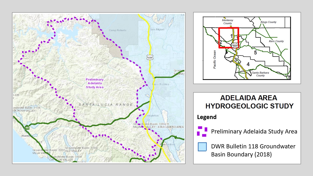
Click here to access the Interactive Data Viewer for the USGS Adelaida study area. This is an interactive mapping system to help you navigate around the study area by panning, zooming, or searching for a specific parcel or street address that you would like to locate. There are different map layers that can be shown and superimposed in this interactive mapping system such as boundaries of groundwater basins, cities, roads, or other entities by checking the layer names indicated on the left panel layer menu.
To search and locate a specific APN or street address on the map:
- Enter either the nine-digit parcel number (APN) including hyphens or the complete street address in the “Search...” bar on the upper right-hand corner of the map screen and then click on the search button to locate it. The APN or street address that you just entered will appear on the left panel and a location marker will show up on the map to identify the location.
- Click on the APN or street address name shown on the left panel layer menu will zoom in to the specified location for a close-up look.
Mailing List
To receive email notifications and updates on the Adelaida area hydrogeologic study, please join the mailing list by clicking here.
FAQs
Data of interest for the study includes well construction information, groundwater level data, water use information, groundwater chemistry data, and geological data.
If you have questions or would like to provide current or historical groundwater data for this study, please contact:
Amy Smart, Conservation Manager
Upper Salinas – Las Tablas Resource Conservation District
(805) 460-7272, Ext. 3
For additonal information on the Adelaida area hydrogeologic study, please visit our partner websites listed below.
- USGS: Evaluation of Groundwater Resources in the Adelaida Area of San Luis Obispo County, California
- RCD: Adelaida Hydrology Study
For additional background information, please click here.
- Attend community meetings
- Provide groundwater data by contacting Amy Smart, Conservation Manager of the Upper Salinas – Las Tablas Resource Conservation District by:
- Email at amy@us-ltrcd.org
- Phone at (805) 460-7272, Ext. 3
- Join the mailing list to receive study updates via email by clicking here