Description
 Pismo Creek Watershed
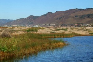
The Pismo Creek Watershed is a coastal basin located in southern San Luis Obispo County. The drainage rises to a maximum elevation of almost 2,865 feet above mean sea level. Pismo Creek flows to the Pacific Ocean where a small estuary forms during the dry season. Pismo Creek watershed has three major tributary basins with their headwaters in the Santa Lucia Mountains: West Corral de Piedra, East Corral de Piedra, and Cañada Verde. A fourth significant tributary, Cuevitas Creek, enters Pismo Creek from the west in lower Price Canyon. The mouth of Pismo Creek is in the dune region known locally as Pismo Beach. The watershed is dominated by agricultural land uses in its upper reaches including vineyards, ranches and row crops. The urban core of the City of Pismo Beach is adjacent to the Pismo Creek Estuary. Other land uses include a regional landfill, oil exploration and a wastewater treatment plant.
WATERSHED OVERVIEW
|
Hydrologic Unit Name:
|
Estero Bay HU 10
|
|
Water Planning Area:
|
South Coast WPA 7
|
|
Acreage:
|
26,030 acres
|
|
Flow to:
|
Pacific Ocean
|
|
Groundwater Basin(s):
|
Edna Valley, Pismo Creek Valley subbasin
|
|
Jurisdictions:
|
County of San Luis Obispo, City of Pismo Beach
|
|
Watershed Plans:
|
Pismo Creek/ Edna Area Watershed Management Plan (CCSE, 2009)
|
Full Data Snapshot
Download the Watershed Snapshot for more detailed information such as:
- Rainfall
- Geology
- Hydrology models
- Vegetation
- Special status wildlife and plants
- Land use
- Demographics
- Major changes in the watershed
- Watershed health
- Groundwater