Description
 Santa Maria River Watershed
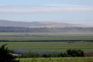
The Santa Maria River Watershed is located in southern San Luis Obispo County and northern Santa Barbara County. The watershed includes the major tributaries of the Cuyama and Sisquoc Rivers as well as a number of smaller tributaries. The Santa Maria River (downstream of the confluence with Cuyama and Sisquoc Rivers) rises to a maximum elevation of approximately 390 feet and flows to the Pacific Ocean. Drainage in the watershed is linked to the soils and geology with a dune lake complex, Black Lake Canyon slough, Oso Flaco Creek and portions of the Santa Maria River within the County of San Luis Obispo. The watershed is dominated by residential and agricultural land uses including ranches, row crops, greenhouses and orchards. Other land uses include recreation and oil refinery.
WATERSHED OVERVIEW
|
Hydrologic Unit Name:
|
Estero Bay & Santa Maria HU 10 & 12
|
|
Water Planning Area:
|
South Coast WPA 7
|
|
Acreage:
|
33,205 acres
|
|
Flow to:
|
Pacific Ocean
|
|
Groundwater Basin(s):
|
Santa Maria Valley
|
|
Jurisdictions:
|
County of San Luis Obispo, Town of Nipomo
|
|
Watershed Plans:
|
Santa Maria River Estuary Enhancement and Management Plan (Dunes Center, 2004)
|
Full Data Snapshot
Download the Watershed Snapshot for more detailed information such as:
- Rainfall
- Geology
- Hydrology models
- Vegetation
- Special status wildlife and plants
- Land use
- Demographics
- Major changes in the watershed
- Watershed health
- Groundwater